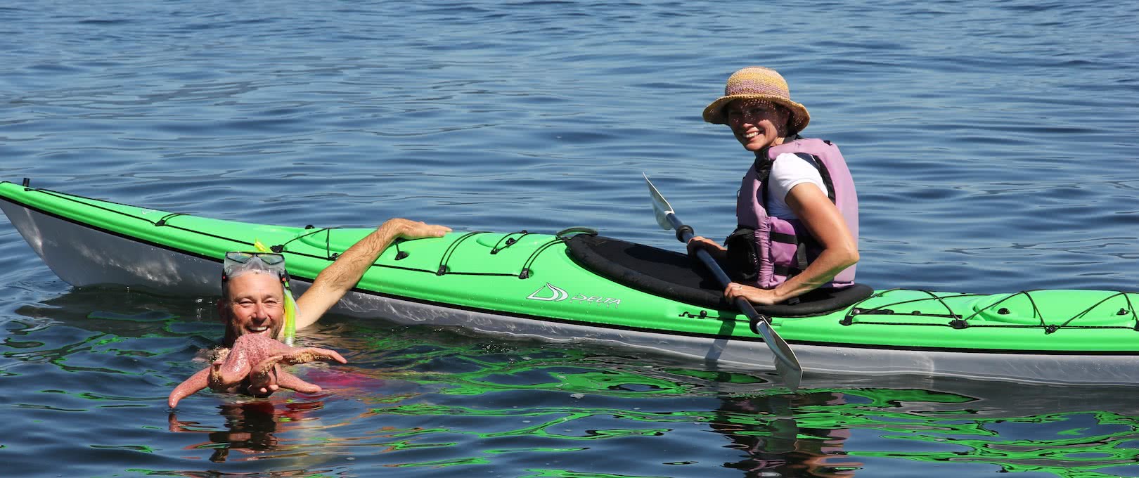
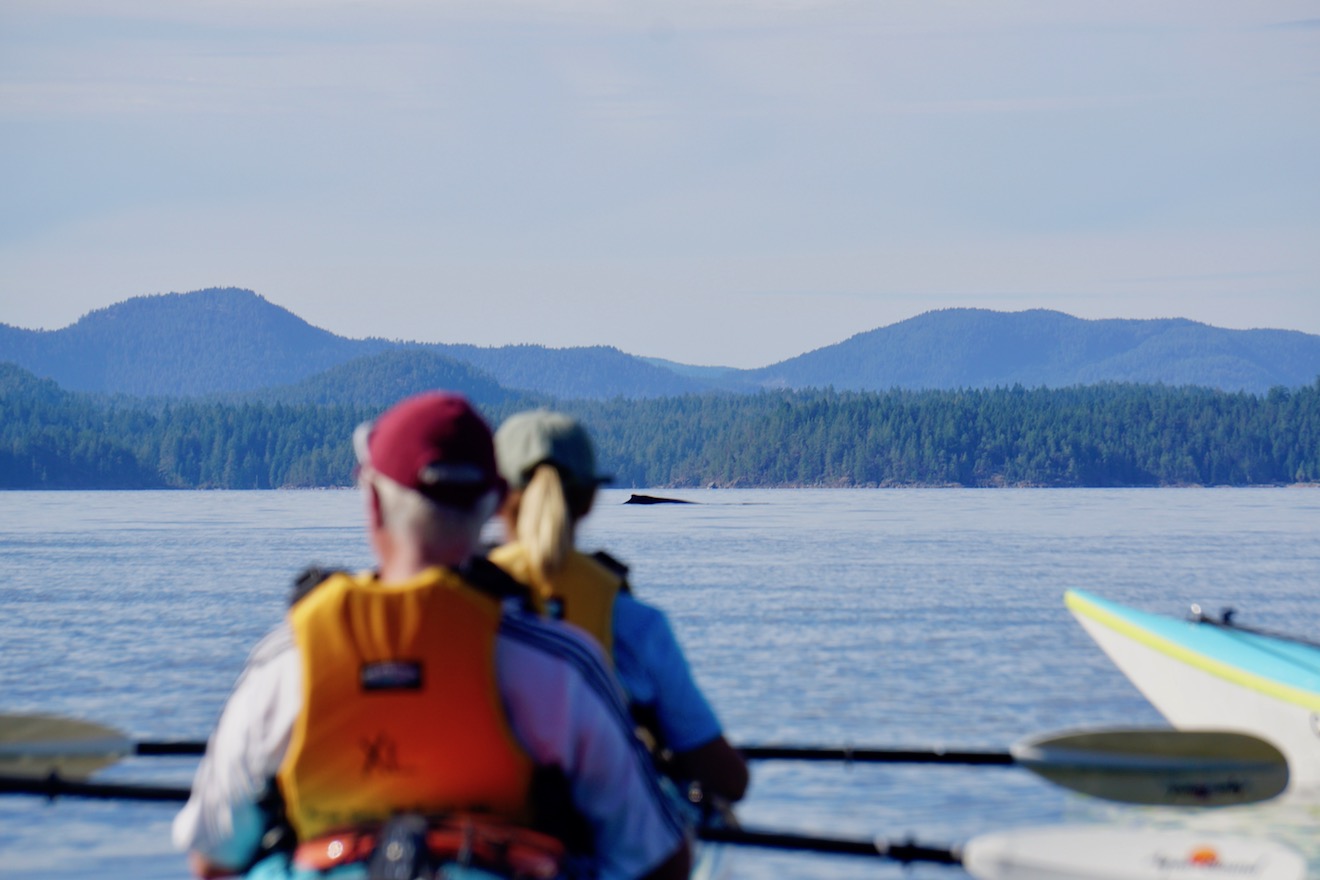
Can You Kayak with Whales in Desolation Sound?

A commonly asked question from guests planning on visiting us in Desolation Sound concerns wildlife: “What will we see and when is the best time to see it?! Is it possible to kayak with whales?!”

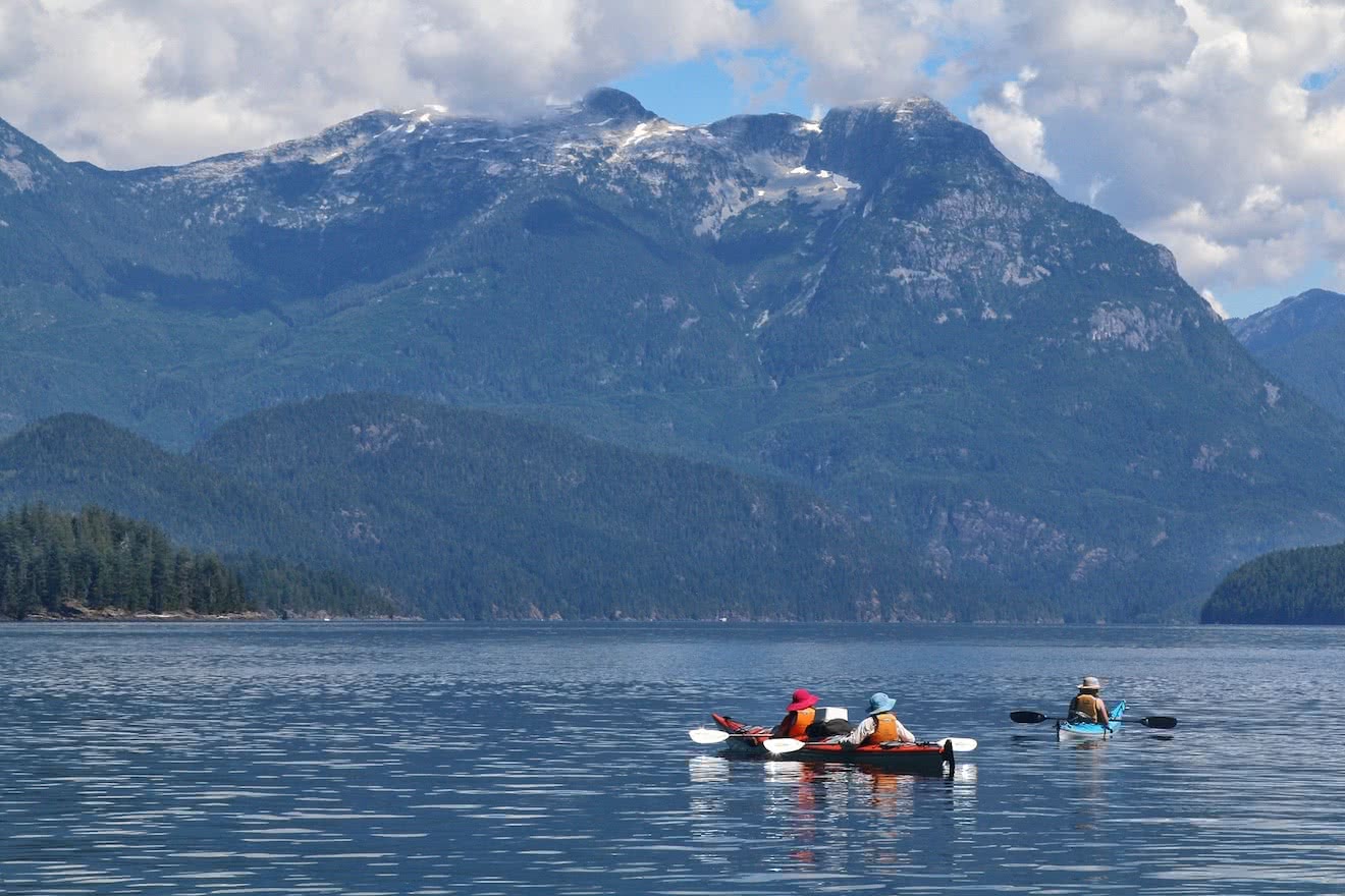
Whales and dolphins are some of the most asked about wildlife, and for good reason! These charismatic marine mammals have fascinated and excited us all for thousands of years. In Desolation Sound we commonly see several types of whale and dolphin, from orcas and humpbacks down to harbour porpoises.

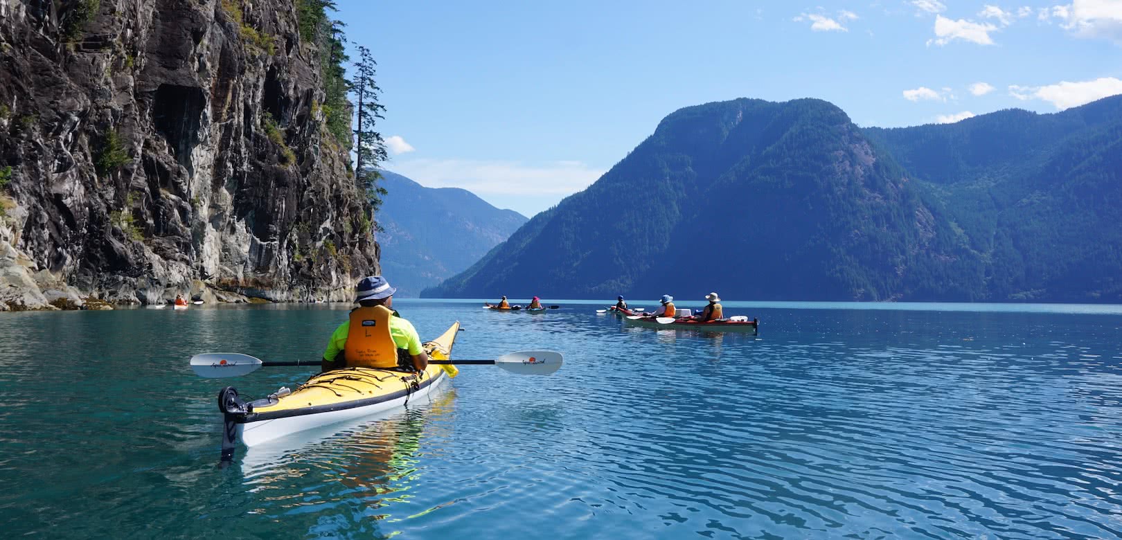
While Desolation Sound is more known for its warm temperatures and striking mountain scenery than its concentration of whale sightings compared to the Johnstone Strait, the increasing number of sightings in recent years has been fantastic to see for our guests and guides alike!

Following is a brief description of each species and their migration patters through Desolation Sound.

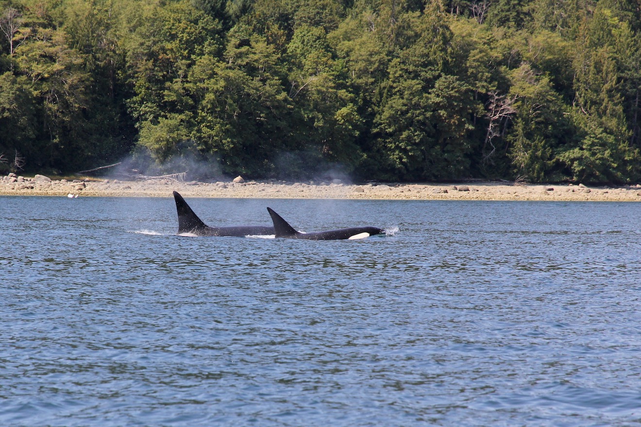
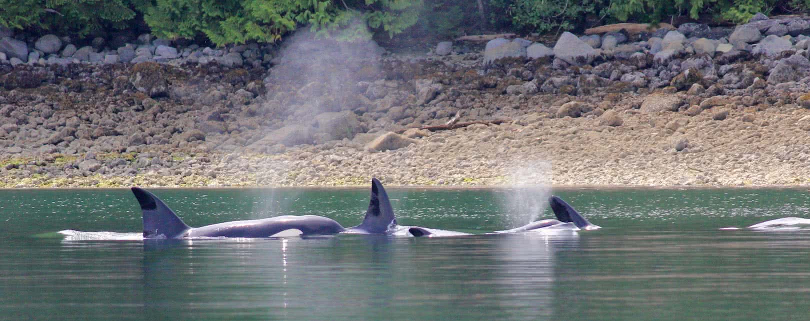
  • Transient Orcas (Killer Whales)

Orcas are fascinating, well-loved, and occasionally feared apex predators that have a well-earned reputation for both astounding intelligence and devastating hunting methods. On the inside of Vancouver Island in British Columbia there are two commonly seen sub species of orca – the resident ‘fish eaters’ and the transient ‘mammal eaters’.

In Desolation Sound, we are far more likely to encounter the transient variety, named for their seemingly range-less movement up and down the coast in search of their preferred prey: the harbour seal. They will also prey on sea lions, dolphins and porpoises; but don’t worry, despite heir ‘mammal eating’ reputation, there has never been a recorded attack on a human by a transient orca in the wild.

Transients travel in groups of 4-6 individuals, while residents are usually seen in much larger family pods. They are slightly larger than residents and tend to have a dorsal fin with a more pointed tip.

We have the potential to see and kayak with orcas in Desolation Sound at any time of year as they roam through the area in search of prey, though it is definitely not a guarantee. We will often have multiple sightings of a group over a 4 or 5 day period, and then a period of no sightings for a while before the pod – or another pod entirely – returns briefly again.

A double kayak with whales in Desolation Sound - A humpback comes up for air in the distance

  • Humpback Whales

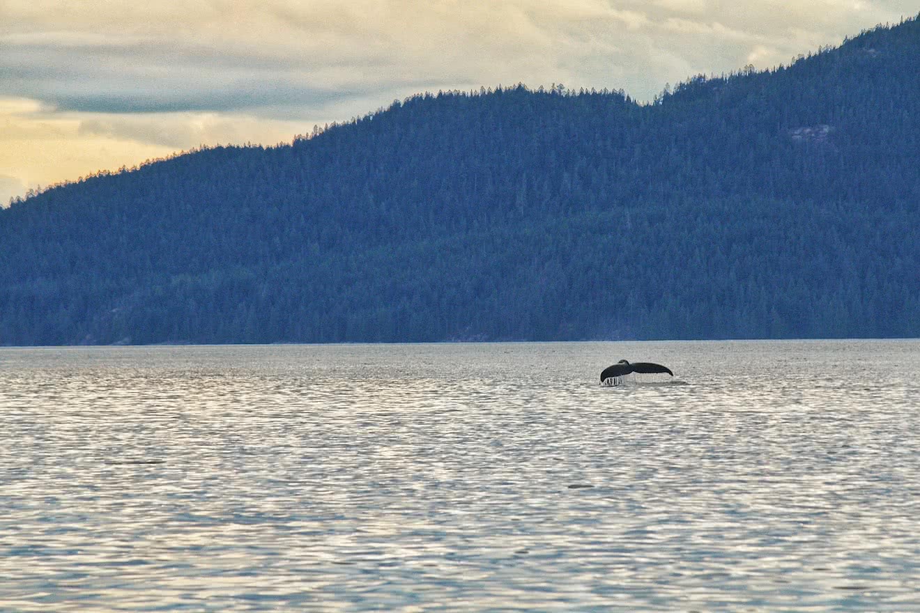
After being fished out of the waters inside Vancouver Island early last century, humpbacks have made a stunning return to Desolation Sound and the Strait of Georgia in recent years. Many of our guests have had the opportunity to kayak with whales such as humpbacks in Desolation!

The typical migratory pattern of humpbacks is to head south for the winter to warmer climates to breed, and then return in the summer to feed in our nutrient rich waters. Anecdotally, we start to see more humpbacks in June in this area, and the numbers increase steadily and peak in late August and September, before the huge mammals begin their migration south en masse.

That said, a small population does tend to remain year round in the Strait of Georgia. The are also noted to be arriving earlier in numbers and leaving later, most likely due to the abundance of food!

Adult humpbacks range in length from 12-16m and weigh 25-30 tons! They have a black body with a stubby dorsal fin, and are usually seen solo or in small groups of 2 or 3. They will usually surface 5-10 times before raising their flukes and diving for up to 20 minutes.

However, lucky guests have spotted these huge mammals breaching and throwing their entire body out of the water at one time. Despite this, biologists are still not quite sure why whales exhibit this exciting behaviour!

  • Pacific White Sided Dolphins

Pacific White Sided Dolphins are usually spotted in pods of up to 50 members, but sometimes they are seen in larger pods of several hundred dolphins or more!

They can be easily identified by white and grey markings underneath and at the tip of their dorsal fin. They are much larger than porpoises, and they often exhibit flamboyant behaviour such as constant breaching and surfing in the wake of ferries and power boats.

Dolphins spend most of their time on the inside of Vancouver Island in the passageways north of Desolation Sound – the Discover Islands, mainland fjords, and into Johnstone Strait. However a couple of times a year there are sightings of large dolphin pods in the Sound and even in Okeover and Malaspina Inlet. Our 5 and 7 day Expedition Tours have a greater chance of sighting dolphins as they head further into these passageways and mountains fjords.

  • Porpoises

Two kinds of porpoise can be spotted in Desolation Sound – the Harbour Porpoise and Dall’s Porpoise – and for the layman it can be hard to tell them apart. The Dall’s Porpoise shows a white dash on the dorsal fin, and is slightly larger than the Harbour Porpoise.

Porpoises can be seen year round and tend to be seen in small pods of 2-5 ‘porpoising’ along at the surface. They rarely – if ever – breach or play, and are far less gregarious than their larger dolphin cousins.

For more information on kayaking with whales, dolphins, porpoises and all other wildlife in Desolation Sound, please check out our Wildlife Page on this website!

Desolation Sound is renowned as a premier sea kayak destination on the British Columbia coast, but few people know that there are a number of great hikes – only accessible by boat in Desolation Sound – that are perfect to break up the paddling.

These Desolation Sound hikes have differing features and difficulties, from forested strolls to freshwater lakes, to uphill slogs to breathtaking vistas. Below are three of our favourites, all easily accessible for kayakers on a Desolation Sound adventure!

  • Sunshine Coast Trail to Sarah Point or Wednesday Lake

The Sunshine Coast Trail is gaining in notoriety among hikers in British Columbia, with 180km of trail and 14 backcountry huts along it’s route.

Few people are aware however that the trail starts at Sarah Point, in the SW corner of Desolation Sound, and can be used for a number of distinct day hikes while you are visiting!

The easiest place to access this trail is at Feather Cove, which is at the tip of Malaspina Peninsula close to the entrance to Okeover and Malaspina Inlets. From the easy landing on the beach the trail heads off in two directions – west to a beautiful viewpoint over Desolation Sound (and eventually the trailhead at Sarah Point), and south through sections of old growth cedar and Douglas fir to a number of freshwater lakes that are perfect to jump into on a long, hot summer day.

  • Llanover Mountain from Roscoe Bay

A rarely travelled trail – by kayakers at least – is the climb to the peak of Llanover Mountain that is accessed by an easily accessed trailhead in Roscoe Bay. The trail is mostly uphill, easy to follow, and takes from 1.5-2 hours one way.

The views from the top, however, are spectacular! From the viewpoint at the end of the trail you can see right back west over Desolation Sound, the Strait of Georgia, Cortes and Quadra Islands, and the peaks of Vancouver Island way in the distance.

Head there early in the morning to beat the heat, and then paddle over the Black Lake at the head of Roscoe Bay afterwards for a well earned swim in a beautiful freshwater lake before paddling home.

  • Unwin Lake from Tenedos Bay

With its location in Tenedos Bay – an easy hour’s long paddle from the Curme Islands – Unwin Lake is a very popular day trip for kayakers base camping in Desolation Sound.

The easy trail from the campsite runs straight and wide through a beautiful, mossy forest. Occasional side-tracks veer off from the main trail and visit the creek leading to the bay. After about 15 minutes the trail meets Unwin Lake, and you can follow it clockwise around the lake and choose a private nook that speaks to you for lunch and a swim in the warm fresh water.

The trail continues further, past great spots for cliff jumping and further away from other visitors. Returning to your kayaks the way you came, another 45 minutes is all it takes to return to your base camp on the Curme Islands.

2019 will be the 25th year that Powell River Sea Kayak has been running kayak tours, offering kayak rentals and lessons, and recently added eco resort packages at Cabana Desolation Eco Resort into Desolation Sound, British Columbia.

Over that time we have cultivated a reputation of quality, safety and local knowledge that has made us the Desolation Sound kayak company.

Why Desolation Sound? What makes this place so special to us, so much so that we have dedicated one quarter of a century introducing it to thousands and thousands of guests from all over the world?

1/ Easy Access, despite being at the End of the Road

Desolation Sound, Okeover Inlet, and the village of Lund are often referred to as ‘the end of the road’ on the mainland coast of British Columbia. At the terminus for Highway 101 north from Vancouver, it is indeed a remote and adventurous place! Deep inlets and immense mountains cut off any potential settlements or road access beyond the Sound, and the further you paddle towards and into the Coast Mountains the easier it is to lose yourself in the scenery and disconnect from the urban world left behind.

However, remote doesn’t necessarily mean difficult to access.

Compared to other premier kayaking locations on the BC coast – from northern Vancouver Island to the Central Coast to Haida Gwaii – Desolation Sound is surprisingly easy to get to from Vancouver and beyond!

A beautifully scenic 5 hour drive – complete with two spectacular ferry crossings – is all it takes from downtown Vancouver to reach the burgeoning seaside town of Powell River, the staging ground of Desolation Sound.

Tour guests can make this travel at a convenient pace the day before they launch into the wilderness, even leaving work on a Friday afternoon in the summer to reach the Upper Sunshine Coast in time for a spectacular coastal sunset.

2/ Warm Ocean Temperatures

A lot has been said about the warm waters of Desolation Sound, but it honestly cannot be overstated how unique this environment is on the west coast.

Tidal streams flowing north through the Strait of Juan de Fuca and south through Johnstone Strait meet in Desolation Sound from both directions, meaning that the Sound does not have large volumes of water coming in and out of the area each day. This means that we do not get strong tidal currents that can be found in other areas inside Vancouver Islands, and that the water has the opportunity to rise to temperatures much higher than anywhere else in British Columbia!

Practically, this means that summer in Desolation Sound can see ocean temps reach comfortably over 20 degrees celsius in places! Swimming and snorkelling are favourite pastimes of guests on our tours, especially after a nice, hot summer’s day on the water.

Opportunities for education and interpretation abound when you can get right close and personal with intertidal wildlife like we do in Desolation Sound. Snorkelling allows our guests to gain new perspectives on this little encountered oceanic world, and the warm temperatures make the experience unforgettable in more ways than one!

3/ Steep Mountain Scenery & Deep Coastal Inlets

The Coast Mountains frame Desolation Sound to the east like no other paddling Destination in British Columbia. Thousands of years ago, glaciers emerged from the peaks above and carved the steep mountain valleys and cliffs that are synonymous with Desolation Sound.

These mountains form an impenetrable barrier that puts any further mainland coastal settlement north of Desolation Sound out of the question, and proved to be the true nemesis of Captain George Vancouver back in 1792 – a wall of ice and rock that disallowed any further exploration of the fabled North-West Passage that he was desperately seeking.

Mount Denman is of course the crowning jewel of the mountain-scape, causing guests to let out an exhalation of breath in appreciation as the scene slowly unfolds as they enter Desolation Sound from Malaspina Inlet to the south.

Further north these steep mountains are punctuated by long, wide, deep coastal fjords that snack their way into the Coastal Mountain range before ending in wide river estuaries that feed untold numbers of birds and terrestrial wildlife.

Toba Inlet is the fjord directly north of Desolation Sound that we visit on some of our expedition tours. Turquoise ocean water meets towering cliffs that rise into immense ice capped mountains thousands of feet above. Ribbons of water cascade – sometimes gently, sometimes with a thunderous roar – from hidden lakes far above, and you can spend a whole day paddling in awe of the grandeur of the scenery without seeing another soul.


Our 7 day multi-day kayak tours paddle into Toba Inlet and move camps every day, unique among British Columbia kayak tours

4/ Islands, Islets, Coves & Hidden Lakes

The grandiose scenery is certainly awe-inspiring, but it’s the small and hidden features of Desolation Sound that make it feel so intimate no matter what time of year you visit.

Uninhabited islands and tranquil coves are found round almost every corner and Countless bluffs, ledges and pocket beaches are perfect for pulling up a comfy camp chair and a good book.

Hot summer days can bring a craving for a refreshing freshwater dip, and Desolation Sound caters to us here as well. Paddle up to a quiet cove, leave your kayaks above the high tide line, and follow mossy trails beneath towering trees to hidden lakes undetectable from the ocean below.

5/ Great Summer Weather

Coastal British Columbia is known as a temperate rainforest, which means that during the cooler, winter months we see a lot of precipitation. Few people know however, that from mid-June to late-July BC actually has the driest weather in all of Canada – and without the muggy, 40-degree temperatures that can be found elsewhere as well!

Long, summer days warming to temps in the mid-twenties celsius are the norm out here in July and August, and couples with water temperatures topping 20 degrees you could be forgiven for thinking your are sitting on a nice southern beach if it were not for the preponderance of granite instead of yellow sand.

Less clouds also gives way to more epic sunsets, something that Powell River and Desolation Sound is increasingly becoming famous for in the age of social media. Deep reds, oranges and yellows dance slowly across the summer sky, the perfect ending to another spectacularly perfect day in paradise.

A guest watches the sunset from her kayak on a multi-day camping tour

6/ Increasingly Diverse Wildlife

We’ve always been proud of the wildlife viewing opportunities in Desolation Sound – from colourful intertidal invertebrates to transient orcas to bears and other terrestrial mammals on the forested shores.

In recent years however we have certainly noticed an uptick of some very exciting sightings. Most recently, humpback whales have been returning to the waters inside Vancouver Island in huge populations every summer for the first time since they were effectively whaled out in the early 20th century. This suggests not only a greater respect for these magnificent creatures from human populations, but also an abundance of microscopic food sources that these humongous animals consume!

7/ Fascinating Local History

Desolation Sound has been home to human inhabitants for over 10 000 years. We acknowledge the traditional stewards of this land – the Sliammon, Klahoose and Homalco – in which we paddle, hike and enjoy so much today. Indeed, there are many illustrations of this cultural and spiritual history past that we can still see and marvel at today – from pictographs in Homfray Channel to clam gardens in Okeover Inlet and shell middens in Prideaux Haven.

From this traditional past throughout European settlement to the modern day, Desolation Sound has always had a rich and colourful story to tell, attracting intrepid explorers and unsavoury vagabonds alike throughout the years, hilariously illustrated recently in Grant Lawrence’s bestselling book ‘Adventures in Solitude’.

—-

As you can see, there is no shortage of adventure to write home about when discussing Desolation Sound, and after 25 years of exploring we find that there are still more stones to turn as we move into our second quarter century of life in this fascinating and beautiful part of the world.

Come join us in 2019 for our 25th season and #experiencedesolation for yourself!

[This is the second and final instalment of a series written by PRSK guide Luke Raftl. Read the first Part of the series here]

Day 4

After 3 days on the move and paddling around 40 nautical miles, the middle day of our adventure was a rest day of sorts. Using the Toba Inlet camp as a base for a whole day, we woke and ate breakfast without the usual hustle, and launched without having to pull down our tents just after 10am.

Our destination was deeper into Toba Inlet, with no set itinerary or plans other than to experience the thrill of paddling into the mountains. Huge granite cliffs plunged on both sides straight into the turquoise waters of the fjord, and every corner we turned gave us a new perspective of the rugged Coast Mountains we had come to explore.

Already, as early as it was, we could feel the first breath of wind being pulled into the inlet by the rising temperatures of the day. These sea breezes – or anabatic winds – are prevalent amongst the coastal inlets of British Columbia. With the warm air over the mountains rising in the heat and being replaced by the cooler ocean air from the west, these winds can easily reach over 25 knots on an otherwise calm day and create wind waves in Toba of over 6 feet!

While for now it was still just a nice breeze at our back, we paddled along the steep cliffs and came underneath a cascading waterfall that dropped from a glacial lake many hundreds of metres above – not quite as thunderous as it would have been in May, still a impressive sight in the mid-summer heat. After paddling a little further into the inlet and taking pictures underneath the silent and majestic peaks, we turned back a with a small pang of regret and made our way back to camp into the building wind.

Using the varied shoreline as cover to get out of the gusts as they funnelled up the centre of the inlet, we comfortably returned to camp in time for a late lunch and some relaxing swimming and reading on the beach, content in the knowledge that more good days of paddling remained on the loop home.

Day 5

We were on the move again on day 5, crossing the mouth of Toba Inlet just after 10am and entering Homfray Channel for our long return journey to Desolation Sound. One guest was overheard over breakfast lamenting that the mountain scenery was all behind them starting from today, and Kyle and I smiled in the knowledge that there were still many breathtaking mountain vistas to come on another perfectly clear and warm day.

We were making great time as we entered Homfray from the north. Our guests were by now supremely confident and comfortable paddling for extended periods with efficient strokes that they could continue all day long. There wasn’t a ripple on the water, our only enemy was the beating sun, that we know would increase in intensity as the day went on.

We paddled past Atwood Bay on the mainland side of the channel in serene conditions, idly chatting away and enjoying the mountain views. Iconic Mount Denman looked much different but no less spectacular from this direction, rising jaggedly above our heads.

Suddenly Kris, one of our guests, stopped mid conversation and stared into the distance.

“I’m not sure, but I think I just saw…”

“Wooooooaaaaaahhhhhh”

We all exclaimed in disbelief as a massive humpback whale came up in the distance, its entire body almost leaving the water and becoming airborne down towards the mouth of Homfray Creek in front of us.

We came together and waited, seconds ticking slowly and breathlessly by.

And then again, on more time, the giant repeated its breach after what seemed like an eternity, but was probably only 15 seconds, as we waited and held our breath.

We all whooped and hollered and the whale – or whales, as we could now see that there were two of them – began moving in front of our path towards the middle of the channel.

For 25 minutes the group sat together, rafted up in silence, taking photos and watching the slow drift of the whales north as they came up together for air, one by one, over and again, before they were long out of sight, and we returned to the paddle ahead.

We had lunch in a nice bay at Homfray Creek, and then jumped back in the kayaks and continued south past Homfray Lodge. High up on the rocks just north of the lodge you can spy old pictographs created in a time long past, and we sat and admired them and tried to interpret their meanings amongst ourselves.

On our left we paddled beyond Forbes Bay and Forbes Creek, directly below Mount Denman itself. The day was getting on and the sun was hot in the sky, and we could feel the energy of the group slowly seeping away.

“Just a little further”, we urged. “Not long now, a couple more bays ahead.”

Finally we reached our goal: a beautiful campsite that looked both north up Homfray Channel to the mountains had left, and west down beyond Desolation Sound again to the rugged spine of Vancouver Island far beyond. It was a wonderful point of land shimmering in the golden afternoon light, and our guests took to the water and swam in the warm ocean temperatures as Kyle and I prepared dinner and appetizers under an incredible Maple tree that reached it’s arm like branches out and over the sea.

Day 6

The day dawned hot and bright again, and we prepared for our return to Desolation Sound.

We had planned the Mountains Tour to avoid Desolation during the August long weekend, and now hoped to return to the Sound at the tail end of the busiest weekend of the year and avoid most of the crowds.

We paddled south along the final mainland potion of Homfray Channel. As we came upon Prideaux Haven – an area renowned as a busy and popular anchorage for sailors and yachts – we could see a number of boats coming and going from the sheltered cove. Passing by along the northern edge of the anchorage, we avoided the traffic jam and then cut in amongst the islands and bays on Prodeaux haven’s western edge, before deciding to continue on and land on the idyllic Curme Islands before lunch, thus giving us all an extended afternoon of rest and relaxation after some long and rewarding days on the water.

The Curmes are popular with kayakers, especially in August, but we arrived early enough in the day to claim the entire southern Curme Isle for ourselves. As the afternoon dragged into evening and the sun began to set in hues of orange and yellow and red over Mink Island to the west, there was plenty of swimming and even some self-rescue practice by some of our more committed guests!

Finally the day ended and we all started to head to our tents, only for another cry to be heard in the night.

“Who wants to see the phosphorescence?!”

Kyle had gone down to clean one last dirty dish in the dark and had discovered that the magical, glowing lights of bioluminescent plankton were dancing beneath the surface of the water. We lingered for half an hour or more as sticks and rocks and eventually a few brave guests went into the water and swam amongst the glowing lights, before we all eventually made our way to our tents for the final time on this grand adventure.

Paddling towards Homfray Channel from Desolation Sound

Desolation Sound is one of British Columbia's premier kayak destinations

Day 7

We didn’t rush on our final morning, and after getting on the water just after 10.30am we crossed in more perfect conditions to the south shore of Mink Island and paddled all the way to the western point, before crossing back into Malaspina Inlet and the final stretch towards home.

The current was rushing into the inlet as we approached, and we relaxed and let the surge of inflowing water carry us almost effortlessly towards our lunch spot in Grace Harbour. After one final meal together upon the bluffs overlooking Okeover Inlet to the south, we silently made our way to Penrose Bay and our launch site, vaguely recognizing the sites we had seen on the first morning of the trip a week ago.

Civilization returned as we closed in on home: first vacation homes on the inlet, then the sight of kayakers looming up in front of us and leaving Okeover for the start of their own journey into Desolation Sound, and then finally we turned the corner and entered Penrose Bay and our destination was in sight.

Friendly staff from PRSK came down to hail us and help us with our kayaks and gear, and in no time we were all standing on the shore and packing our vehicles and saying our goodbyes.

After being threatened with storms of wind and rain in the lead-up to the tour, this turned out to be some of the best paddling weather we experienced all summer in Desolation Sound! With a group of committed guests – with fantastic attitudes – that were all eager to learn and experience this special area of the BC mainland coast, this 7-day Mountains Tour was a highlight of the season for us here at Powell River Sea Kayak.


For more information about out 5- and 7-day kayak expeditions, please click through to our Expeditions page on this website!

[This is Part 1 of a 2 Part Trip Review Series written by a Powell River Sea Kayak guide — read the second part here]

On the August long weekend last year, seven intrepid guests and two guides from Powell River Sea Kayak took the opportunity that the fantastic weather presented us and paddled beyond Desolation Sound. 

Over the course of a week we paddled in awe of immense mountains, beneath plunging waterfalls, and in the presence of majestic humpbacks. Our campsites were remote and beautiful, far off the beaten trail and laid out under a sheet of stars. 

If you are interested in how an expedition-style tour with Powell River Sea Kayak plays out: from how much paddling occurs to the places you may visit to the things you can see, please read on!

Day One

The morning was grey, but the clouds were beginning to part as we launched from our home base in calm and protected Okeover Inlet on the first morning of our adventure. 

The long-term weather report leading up to the trip was decidedly winter-like for the BC coast … but about 36 hours before guests arrived there was a sudden change, and the rain and wind forecast was instantly replaced with sun and warmth. In reality the seven days that we paddled into the mountains and back again saw probably the most perfect weather of the entire summer!

Our group consisted of 3 siblings and 2 spouses from Toronto, Ontario, as well as 2 friends from the west coast of BC that had completed one previous kayaking tour on Vancouver Island many years prior. Kyle and I – guides for this exciting expedition-style trip into the waterways of Pryce Channel and Toba Inlet north of Desolation Sound, rounded out the party.

We launched in the late afternoon and paddled with a slight tail wind north towards the mouth of Malaspina Inlet and the entrance to Desolation Sound. Passing our usual lunch spot in good time, we continued on and entered the Sound on the western side of the inlet and stopped for lunch after 2.5 hours of paddling at Feather Cove at the tip of Malaspina Peninsula.

After lunch we made two crossings, first to Kinghorn Island (the site of Cabana Desolation Eco Resort and beyond that a campsite that we often stay on the first evening of a tour), and then once more crossed to the Martin Islands in the northern part of Desolation Sound, a total of 9.5 nautical miles.

Desolation Sound is a key part of this tour – and we spent two nights here, the first and the last – but we were all looking north at what was to come in the coming days. After a wild salmon and risotto dinner everyone was slightly sore but very content as they went to bed just after the sun set over Cortes Island.

Kayaks at the tide line during a quick break on on of our sea kayak expeditions 

Day Two

We woke to the clear skies that came to dominate the rest of our adventure. A breakfast of scrambled eggs, sourdough toast and vegetable hash fuelled us up for the day ahead – the longest planned for the whole trip, from the Martin Islands north through Lewis Channel, beyond Teakerne Arm and Redonda Bay to a private tenured campsite just south of Connis Point at the tip of West Redonda Island.

The wind was light but variable as we paddled past Refuge Cove and attempted to settle into a rhythm for the day. Perhaps the muscles were a little stiff – and maybe the current was not in our favour – but the first leg of the day required everyone to dig a little deeper than yesterday as we approached the mouth of Teakerne Arm. Kyle and I traded places throughout the morning to check in on everyone and see how they were feeling. We continued to hone in on our guest’s strokes, striving to help them achieve greater efficiency that would come in incredibly helpful over the rest of the tour. After a brief discussion, we decided to stop for lunch a little earlier than originally intended to give everyone a nice break and rest before the afternoon push to camp.

After a quick switch of kayaks to give those of us feeling a little weary a chance to paddle together in a double, we launched again and headed north beyond Teakerne Arm. Conditions now were perfect – a slight tail wind and an ebb current that pulled us northwards. 

Any time lost in the morning was quickly regained, yet as this was the day of our longest paddle, we still had a ways to go! As we reached Redonda Bay and the north-west tip of West Redonda Island, the mountains we had been searching for started to impose themselves on the scenery, and we stopped for a quick break one last time before our last push to camp directly opposite the impressive mass of Raza Island and the beginnings of the Coast Mountains to our north.

Not too many people camp this far north of Desolation Sound, and Kyle and I immediately set about creating a makeshift kitchen from whatever scanty pieces of driftwood we could find while our guests set themselves up with their tents and poured themselves a well-earned glass of wine.

Dinner tonight was Thai chicken and tofu lettuce wraps with hot coconut fried bananas for dessert – not bad fare for the remote environment! And to top it off, just as we sat on the cliff at the edge of camp to enjoy our meal, a humpback whale surfaced directly in front of our vantage point – less than 100 feet from our camp – and took 3 or 4 breaths in succession before diving deep into the channel on its way south. The perfect end to a long but incredibly rewarding day!


We serve creative, colourful meals like this on all our multi-day kayak tours

Day Three

The sun was peering over the rugged spine of West Redonda Island early on Day 3, illuminating the forest on Raza Island to the west and bathing the mountains to the north in brilliant light. We were all up early, devouring another delicious breakfast – butternut squash & leek pancakes today – before we hit the water as a group just as the sunlight reached over the towering trees behind our campsite and landed on our departing kayaks.

The water north of the Redonda Islands takes on a greenish hue, which shifts into tones of turquoise and blue as you turn to the east and paddle closer to the mouth of Toba Inlet. This is due to the glacial runoff that enters the sea from two rivers right at the head of Toba, and it conjures a feeling of more tropical environments than the temperate rainforests of the Pacific North West.

In fact, the entire terrain north of West Redonda Island feels more like the Hawaiian Islands or the coast of Thailand than anywhere else on the west coast. The lush green rainforest on both sides of Pryce Channel, where we were now paddling, drop precipitously straight into the greens and blues of the ocean, and water cascades down narrow ravines carved into the rugged island and mainland landscapes from lakes far above.

Ahead of us, to the east, we could see the first of the snow capped peaks that frame magnificent Toba Inlet, our destination for the day. With every stroke we approached closer, and once again a slight wind appeared at our back – this one caused by the inflow of cooler, ocean air rushing in to replace the warmer air above the sun-drenched mountains – which pushed us ever nearer still.

We crossed Pryce Channel after half an hour or so and were now paddling along the mainland coast. Perhaps one or two sailboats were spotted all morning, far in the distance, and it felt as though we were alone in this remote and awe-inspiring environment.

We rounded a point in the mainland and came upon a simply perfect beach of crushed rock and sand right at the mouth of Toba Inlet for lunch. From here the great, steep fjord twisted and turned its path right into the icy peaks of the Coast Mountains, which we could appreciate from our comfortable position in the sunshine thousands of feet below. 

Our guests all went swimming in the blue ocean to cool down as Kyle and I prepared the lunch.  Two and a half days of kayaking had turned everyone into efficient paddling machines, and while we were grateful for our idyllic lunch spot, everyone was just as eager to get back on the water and travel deeper into the mountains.

Our afternoon paddle along the north-western shore of Toba was in perfect, calm conditions and almost complete seclusion (with the exception of one solo kayaker that approached us from the south-east to ask for some campsite information, and then paddled alone back in the direction from which we came!) 

Our campsite in Toba Inlet is another private tenure that we maintain for the exclusive use of our tour groups, and the perfect place to base ourselves for further exploration of this remote and impressive destination deep amongst the BC Coast Mountain range.

Our plan was to do just this – spend two nights at our comfortable base and paddle deeper into the inlet on Day 4, before resume our loop of the Redonda Islands and returning to Desolation Sound in the days to follow.

Our camp was another perfect beach of crushed rock and sand that received most of the day’s sun, with multiple tent spots hidden just beyond the trees in the cool shade of the forest behind us. Kyle and I set up our kitchen away from the tents – this is bear country after all – and set about creating another rich and fulfilling meal of Pasta with Pesto, Artichokes, Sun-dried Tomatoes and Black Olives, before the sun set over the mountains that now lay to our west and we all climbed into our tents in anticipation of exploring Toba Inlet in the morning.

To be continued…

A kayaker sitting and enjoying the view on one of our 7 day sea kayak expeditions in Pryce Channel

What is the Best Length of Time to Kayak in Desolation Sound?

While it’s true that you can spend weeks in Desolation Sound and its surrounding waters and still have more to see, we find that between 4-6 days is the best amount of time for an average kayaker to truly immerse themselves in this wonderful landscape.

Desolation Sound can be enjoyed in an infinite number of ways, but one constant we often notice is that many of our guests – whether on tour or renting kayaks and going out themselves – are looking primarily to destress, unplug, and relax in a beautiful corner of the BC coast.

The following 5 day kayak route has thus been developed to facilitate the above desire. Please note that in order to reach the best spots, you do have to work a little to get there! We are strong believers that the best rewards are earned through a little effort first, and so our recommendation below involves three ‘paddling’ days of moderate activity, and two ‘rest and relaxation’ days where the script is up to you. Two base camps allow a good blend of relaxation and exploration.

Day One: Okeover Inlet to the Curme Islands
Pick up your kayaks and equipment from our waterfront location on Okeover Inlet and paddle north through these protected waters to access Desolation Sound. Check out Grace Harbour on your way north and continue up the eastern shore of Malaspina Inlet to Hare Point, where you will find a campground and picnic area on a stunning bluff for a shoreline lunch.

There are minor currents in the waters immediately to the south and north of Hare Point that can run up to 3 knots at their maximum speeds, so be sure to plan your route through this area appropriately if the current is indeed working against you on this morning. Typically, keeping close to shore utilizes a number of large eddies found in Malaspina Inlet and minimizes he amount of time you need to spend fighting against the flow!

After lunch, get  back in your kayaks and continue north along the coast for another 25 minutes or so until you round Zephine Head and enter Desolation Sound. The Coastal Mountain Range will slowly fold into view as you come around the corner, including the dramatic peak of Mount Denman rising 7000 feet high.

Depending on the wind conditions, you may choose to cross straight to Mink Island in the middle of the sound or follow the coast past Galley Bay before crossing in the lee of Gifford Peninsula for protection. Once you reach Mink Island, skirt along its southern shore until the Curme Islands come into view on the eastern side.

There are three islands in the small chain that you can camp on, with more than 30 tent pads, 3 pit toilets, and a handful of kitchen areas between them, and the pads are set up so that large groups and small can share the islands together without even being aware of each others existence.

The Curmes are a popular site for kayakers due to its beautiful location at the foot of the mountains and its central location in Desolation Sound, making it the perfect place to base camp for a couple of nights of rest and relaxation.

Day Two: Curmes Base Camp
From your Curmes camp you can radiate in any direction for a relaxing day paddle, or choose to stay put and enjoy a warm swim and snorkel in the warm, bright blue waters of Desolation Sound.

Popular day trips include visiting Black Lake in Roscoe Bay or Unwin Lake in Tenedos Bay, both about an hours paddle from camp in different directions, and exploring the spectacular island chains in Prideaux Haven to the northeast.

Personally, we like to combine an exploration of Prideaux Haven with a freshwater dip and lunch at Unwin Lake. Paddle northeast from camp into Prideaux Haven and choose your own route through the islands and islets, being sure to look for intertidal marine life and sunbathing seals and sea lions as you go.

The deeper you go into Prideaux Haven, the more yacht and sailboat traffic you will encounter, so return via the small channel between Otter Island and the mainland (hint: check out the zunga, or ropeswing, on a hot day) and continue round Bold Head to the south and into Tenedos Bay. At the far end of the bay you can land your kayaks and continue to walk about 5-8 minutes along a trail into the cool forest, until you reach Unwin Lake, which is an awesome spot to swim, eat lunch, and explore the rock ledges for the ultimate cliff jumping locations. This lake warms up on hit summer days to delightful temperatures.

From here, it is an easy 45 minute paddle back to camp, and a delicious meal and glass of beer or wine in the evening light.

Day Three: Curme Islands to North Copeland Island
Pack you gear and get a good breakfast, because it’s moving day! Launch from the Curmes and follow the northern shore of Mink Island this time as you head west away from the mountains in the direction of Vancouver Island far in the distance.

From the western tip of Mink Island, cross back to Zephine Head on the mainland and cross the mouth of Malaspina Inlet until you reach the shore of Malaspina Peninsula. There is a large beach facing Kinghorn Island on the northern shore named Feather Cove, which is an easy place to land and a great spot for lunch after an active morning.

After lunch, keep heading south round Sarah Point and into the northern Strait of Georgia. Follow the peninsula south now beyond a number of small bays and homesteads until you reach a small community called Bliss Landing. Directly west of here lies the northernmost of the Copeland Islands. Watch for boat traffic here while crossing to the island chain, and you will find a campsite with more than 10 tent pads, a pit toilet and a few separate kitchen areas with incredible views of the Salish Sea and Vancouver Island.

If this site is taken, there is a second site with 8 tent pads immediately to the south of the North Copeland Island which is just as scenic – and a little more protected from a northerly wind.

Day Four: Copeland Islands Day Trip
One of our favourite day trips, the Copeland Islands are an incredible place to view marine and bird life as you pick your own path between 4 large and multiple small islands and islets in the chain. Numerous small bays and coves are found throughout the protected islands for lunch with a view of Vancouver Island and Savary Island to the south.

The Copelands have a large number of bald eagles, as well as many species of shore birds and waterfowl, such as mergansers, harlequin ducks, and the tiny but diminutive marbled murrelet. The most southern island in the chain in particular has great marine life on display at low tide, including sea stars, sea cucumbers, big red spiny urchins and even gumboot chitons.

If you have time and the weather is calm, a quick circumnavigation of nearby Major Rock to the west is a fascinating side-trip. This bare rock jutting out of the Strait of Georgia houses many colonies of birds, seals, and even year round sea lions! Please do not get too close to sunbathing seals and sea lions during your paddle so as not to frighten them, but no matter, as you’ll no doubt hear (and smell) them before you get too close anyway!

Return to camp whichever way you choose and settle in for a spectacular sunset over Vancouver Island, and prepare for your return to reality tomorrow.

Day Five: North Copeland Island to Okeover Inlet
Cross back to the mainland from the Copelands and paddle north back around Sarah Point and beyond Feather Cove and into Malaspina Inlet. We like to visit the opposite shore on the way back to base, so continue down the inlet’s western side through the narrow portion (where there may be more currents) and into Cochrane Bay, which is opposite Grace Harbour and another nice place for lunch.

From here, you can cross the inlet to the top of Coode Peninsula at the Isbister Islets and continue south back to Penrose Bay, where you launched from 5 days and many wonderful memories ago.

Desolation Sound is world famous for it’s remarkably warm ocean temperatures, which routinely reach 22 degrees celsius (74 degrees Fahrenheit) during those long, hot summer days of July and August.

As great as cooling off in the ocean can be, however, we know that nothing quite beats a freshwater soak in a warm, clean lake to wash away the salt of a mid-summer multi-day kayaking adventure.

Check out these incredible freshwater lakes easily accessible from Desolation Sound, perfect for a quick dip or an entire day or rest and relaxation.

Unwin Lake

This one is famous – accessed from the pullout in Tenedos Bay, a mere 45 minute paddle from the Curme Islands – Unwin Lake is a popular and attractive day trip paddle from your base camp in the heart of Desolation Sound.

From the campsite in Tenedos Bay, follow the trail for 10 minutes through an ancient temperate rainforest amongst humongous trees, and then choose your path to the left or the right hand side of the lake and find yourself a secluded corner to eat a lazy lunch, swim in the sun, or jump from a shoreline cliff into the warm water below.

The trail from the bay to the lake itself is a wonderful experience, with a number of side paths that snake away from the main trail and bring you to the base of an ancient old-growth cedar or a secret corner alongside a babbling waterfall flowing from the lake into the bay below.

Camping nearby include the Curme Islands, Tends Bay itself, as well as Bold Head at the entrance to Tenedos Bay – all of which are located within Desolation Sound Marine park and include tent platforms, pit toilets, and basic backcountry kitchen and picnic areas.

Black Lake

Another centrally located lake, Black Lake is found at the head of Roscoe Bay on the south eastern corner of West Redonda Island, about 90 minutes paddle from the Curme Islands to the south.

Roscoe Bay itself is a beautiful, narrow fjord that is a popular anchorage in the summer months with sailboats and small yachts. At the head of the Bay is an easy landing at a small campsite with an obvious trail beside a rushing creek to the lake. The trail arcs off to the right hand side once you reach the lake, and splits off in a number of places to reveal secluded places for groups or couples to find some privacy and relax along the shoreline.

Black Lake is probably the warmest of the lakes in Desolation Sound, and another perfect day paddle from a base camp on the Curme Islands. A short portage with empty kayaks is also possible along the flat trail, opening up even more potential exploration and adventure!

Wednesday Lake

Little known to kayakers, but well known to summer hikers of the Sunshine Coast Trail, Wednesday Lake can be accessed via a 30 minute hike from Cochrane Bay in Malaspina Inlet, about 2 hours paddle north of our launch site in Penrose Bay.

Paddle into the small pullout in Cochrane Bay and follow the trail to where it intersects with the marked Sunshine Coast Trail, where you can take a left turn and follow the trail in a southerly direction up and down for half an hour to reach the lake – perfect for a refreshing swim after some physical activity!

Wednesday Lake is warm, clear, and remote – meaning that you will very likely have the entire place to yourselves while you are there, with the possible exception of the occasional through hiker on the trail.

The lake is most easily accessed as a day trip from the campsites at Grace Harbour or Hare Point, about 30 or 40 minutes paddle from each, and is often used by kayakers as a great way to stretch the legs and embrace a different form of exercise during a sea kayak expedition in Desolation Sound.

Note: This article is intended for informational purposes only. It is each individual’s responsibility to mitigate risks from shellfish-related illnesses by doing their own personal research using official and scientific sources. 

Harvesting fresh oysters, clams and mussels on a kayak trip is one of those quintessential west coast experiences.

We have been harvesting shellfish on our guided kayak tours for more than 20 years, and it is a highlight of many of our guests trips. We’ve even converted our fair share of non-oyster eaters into shellfish connoisseurs! Though to be fair, with ingredients this fresh, it’s difficult to go wrong.

However there are some critical things to know before you collect, and with the recent outbreak of norovirus cases related to BC oysters throughout Canada, we’ve seen that you cannot be too careful when harvesting and ingesting shellfish in a wilderness setting.

Licensing and Permits

Every person that harvests shellfish of any kind in Desolation Sound must be in possession of a BC Tidal Waters Sport Fishing Licence. These can be purchased online from the Department of Fisheries website.

An annual licence costs $22.05 for Canadian residents, and $106.05 for non-residents (non-residents are probably better off buying a 3 or 5 day licence for their trip, at a fraction of the yearly price).

Daily limits exist for all shellfish harvesting. Among the more common species harvested recreationally, each licence holder can harvest 15 oysters, 75 manila and littleneck clams, and 75 blue mussels per day.

You need to carry the licence on you at all times, whether online (displayed on a smartphone) or a printed copy. Fisheries officers require that the licence be able to be shown immediately on request, so it is always a good idea to have a printed copy on you at all times.

Red Tide

The most famous cause of shellfish poisoning in British Columbia is from eating oysters or clams that are affected by ‘red tide’, or Paralytic Shellfish Poisoning (PSP).

Red tide is the result of an algal bloom, usually, but not always, occurring in the warmer months of the year. Bivalve shellfish (including oysters, clams and mussels) filter the microorganisms and accumulate the toxins at a level that can be fatal for human consumption.

When the toxins are concentrated in the ocean in high numbers, this bloom can appear as a red or dark cloud in coastal waters – hence the nickname ‘red tide’. However, just because you cannot see this phenomenon does not mean that the toxins are not present, and though these blooms are typically associated with warmer waters, red tide can be present in every month of the year.

It is critically important to check the Department of Fisheries website for red-tide updates before ingesting any shellfish harvested on a kayak trip. This information is collected by the DFO in conjunction with the commercial shellfish industry, is updated regularly, and can change rapidly. An open shellfish area at the beginning of the trip can be closed abruptly by the end of the same week, and so bringing a smartphone to check for updates every day you are harvesting is ideal.

It is also important to correctly identify the species of shellfish you are harvesting. Clam species in particular can be difficult to identify to the untrained eye, and certain species hold the toxins for a much longer period than others.

Click this link to be taken to the updates for red tide on the BC coast. Desolation Sound is area 15-5.B, while Okeover and Malaspina Inlets are area 15-4, and the Copeland Islands and Lund are area 15-3.

Alternatively, you can call 1-866-431-3474 for a telephone update with a pre-recorded message on constant loop.

Norovirus

As of March 7th 2017, there have been 289 confirmed cases of gastrointestinal illness connected to eating BC oysters across Canada. Testing of several of these cases has confirmed the presence of norovirus infection, a group of viruses that cause gastroenteritis commonly found in oysters that have been contaminated before being harvested.

None of the reported cases have been fatal, and most people report feeling better in one or two days, however these cases reinforce the importance of proper food preparation, especially in a wilderness environment. A Desolation Sound kayaking adventure is no place for a sudden gastrointestinal illness!

Despite the recent outbreak, risk to Canadians is very low, and norovirus illness can be avoided if oysters are cooked to an internal temperature of 90 degrees celsius (195 degrees Fahrenheit) for a minimum of 90 seconds.

Some other tips for avoiding infection:

  • Discard any oysters that do not open upon being cooked (for example, over a campfire)
  • Eat oysters immediately after cooking them
  • Always keep raw and cooked oysters separate
  • Wash your hands with soap and disinfect with hand sanitizer before handling any food. Norovirus is very contagious and can spread quickly from person to person. Make sure all hands, cutting boards, counters, plates and cutlery are washed and disinfected after use.

What Should I Cook on a Kayak Trip?

Compared to hiking, overnight sea kayak trips can be luxurious.

Seriously, you can fit a lot in a sea kayak. On our guided trips we frequently bring – along with clothes, tents, sleeping pads and bags, and group tarps – well, everything but the kitchen sink.

Two burner stoves, pots and pans of all sizes, 5lb propane tanks, assorted coffee making devices (“Do you want espresso or french press?”) and of course bags and bags of fresh food.

You don’t have to go as far as we do, but what we’re saying is, you don’t need to eat badly on a sea kayak trip.

While it may be easier to pop into MEC and pick up a whole bunch of those bags of freeze dried Pad Thais and powdered egg breakfasts, with just a little bit of planning beforehand you can whip up all manner of tasty, simple, and damn right impressive meals for your friends, partner, or family with a minimum of fuss.

To get your creative flowing, we’ve included here three relatively easy meals that are sure to win you all sorts of brownie points when you’re in Desolation Sound next summer.

Breakfast – Savoury Oat and Lentil Breakfast Bowl

Quick, tasty … and healthy. This breakfast is far more exciting than regular ol’ oatmeal, and the veggies add colour and freshness to this hearty breakfast bowl.

Ingredients: (serves 4)

3/4 cup rolled oats

2/3 cup red lentils

3-3.5 cups vegetable broth

2 small shallots diced (or 1 small onion)

3 cloves garlic minced

2 chopped green onions

150g white mushrooms sliced

150g cherry tomatoes halved

2 avocados sliced thinly

Salt & pepper to taste

Put the oats, lentils, shallots and garlic in a camp pot with the broth and bring to a boil, then turn the heat down and simmer without a lid until the lentils and oats become soft and the broth evaporates, about 8 minutes. Add salt and pepper to taste.

Meanwhile chop up the mushrooms and the tomatoes and saute briefly in a small pan until the mushrooms become golden brown.

Ladle the lentils and oats into individual bowls and throw the mushrooms, tomatoes, avocado and green onions on top. Serve immediately.

Lunch – Mango Black Bean Salad

This is a classic! You can make this at home if desired for a quick first day lunch, but it is easily put together in the morning while making breakfast to take with you on your daily paddle in a Tupperware container. Hint: completely drain the beans before adding them, otherwise the salad takes on a washed out grey appearance (though it still tastes great).

Ingredients: (serves 4+)

2 cans black beans

2-3 mangos, peeled and diced

1 red pepper, chopped

1 small red onion, chopped finely

1 bunch cilantro, chopped finely

1 cup corn kernels, roasted (optional)

2 cloves garlic

1 Tbsp cumin

Juice of 1 lime

Dash of olive oil

Sea salt to taste

Roast the corn in a pan until they are golden brown (and throw the garlic in there too while you’re at it) and then throw all the ingredients in a container and you’re good to go!


Dinner – Mediterranean Pesto Pasta

This is simple meal that can be switched up and created in almost endless ways with whatever ingredients you choose. Spicy salami or Italian sausage along with the artichokes and sun-dried tomatoes gives this a Mediterranean vibe, but can easily be omitted or left out till the end to make it vegetarian.

Ingredients: (serves 4)

Olive oil

400g rotini pasta

4 Italian sausages, chopped in 1/2 inch pieces

2 cloves garlic, minced

2 tbsp chives, chopped

1 red pepper, chopped

1 can artichoke hearts

1 can chickpeas, drained

1 small can or bottle sun dried tomatoes

1 bunch spinach, chopped

150g olives (optional)

1 200g bottle green pesto

Splash the olive oil and the pepper and garlic in a pot over medium heat and cook for 5 minutes. When peppers are soft, throw in the artichoke hearts, and chickpeas and cook for 5-8 minutes, then add the sun-dried tomatoes and reduce the heat to low and let simmer for 10 minutes more.

In the meantime, cook the pasta according to the packet instructions. If you are using them, tae the sausages and fry them up separately so that you can leave it out for any vegetarian paddlers.

Just before the pasta is cooked, add the chopped spinach to the pot with the pesto. Drain the pasta and mix it all together with the sausage. Serve!


Desolation Sound is a coastal BC summer paradise … yet while many paradise seekers aim to explore this area in July and August to maximize their chances of perfect weather, there are endless reasons that a June – or even May – Desolation Sound escape can be just as rewarding.

Here are six of our favourites:

1. Off-Peak Rates!

Whether you are joining a multi-day camping tour or spending a weekend at Cabana Desolation Eco resort, if you are kayaking with us before June 25th you stand to receive some juicy discounts.

Our Off-Peak Group rates are our best rates, and you only need a group of 4 to receive this discount during these Off-Peak times. That means savings of up to $150 per person for camping tours and up to $330 per person for Cabana Desolation packages!

Renters can also save money by kayaking earlier in the season, but please note the off-peak cut-off date for renting kayaks and equipment is May 15th.

2. Pleasantly Comfortable Temperatures

While hot summer days are perfect for swimming and snorkelling in Desolation Sound’s warm ocean waters, paddling in the heat of summer can be a brutal exercise.

June days are typically a little cooler than July and August on the coast – around 4 degrees on average – or the difference between a comfortable day of activity outdoors and a gruelling sweat in the heat! 

3. A Truly Peaceful Holiday

From avoiding jostling in ferry lineups on the way up from the city to paddling into a serene wilderness, there’s a lot to be said about an early season kayak trip if you’re looking for peace and quiet.

Like all BC coastal communities, Power River and Desolation Sound has its peak tourist season in July and August – particularly within two weeks either side of the August long weekend.

A June visit to Desolation Sound is comparatively quiet. Sure, you get the odd sailboat or small yacht chugging down the inlets or on their way to Prideaux Haven, but it is far easier to get away from it all at this time of year and still enjoy nice long summer days.

Speaking of which…

4. Loads of Daylight

Those long, warm, early summer days are made for kayaking in British Columbia – it’s amazing how much you can fit into them!

Up early with the sun as it warms the outside of your tent, drinking your morning coffee in peaceful silence, a lazy breakfast with family and friends, then into your kayaks for a full day of exploration and adventure.

Back at camp in the afternoon, the sun is still high in the sky – plenty of time for swimming and snorkeling at camp – and then a cold drink and another relaxing meal with plenty of time to watch the sunset before twilight returns.

The summer solstice is June 21st, and in Desolation Sound at this time of year the sun does not set until around 10pm. It peeks over the Coast Mountains in the morning usually before even the earliest risers in any camp group, meaning there are plenty of daylight hours to explore, or relax, in Desolation. 


5. Potential for Campfires

What could be more satisfying after a long day of exercise than sitting back and warming your feet by the campfire?

The last few summers in BC have been extremely hot and dry, and total campfire bans have been introduced well before the month of July. Early season paddling increases the chances of paddlers being able to safely and legally enjoy small campfires for warmth and atmosphere in the Desolation Sound area!

Please note: Within the provincial parks, campfires are only permissible at sites that are equipped with specific fire rings – at this point these sites are Tenedos Bay and Grace Harbour. Campfires are however permissible at sites that lie outside park boundaries as long as their is no campfire ban in place. Please keep all fires small and manageable, and be sure to put them out completely before retiring to your tents or going out for a paddle.

For guests on our guided trips, our private tenures outside the park boundaries mean that we can enjoy campfires in these early season months before any fire bans come into effect!

6. Early Season Wildlife

Many birds, mammals and even invertebrates are migratory – from the long, gruelling journey of the big whales from breeding grounds to feeding grounds, to the relatively subtle shift of certain sea stars deeper in the water column due to the warm summer water – many animals move with the seasons.

Aside from whales such as humpbacks, sea lions are far more likely to be encountered in May and early June before they head north or south to their rookeries. Sea cucumbers and sea stars such as the vermillion star tend to be found deeper in the intertidal zone during the summer.

Bird life, too, shifts with the seasons. Loons, grebes and certain species of duck are far more common on saltwater during the spring – not to mention the colourful winter plumages of certain waterfowl that fade in the early summer months!

———

To check availability and book a 2018 Desolation Sound kayak adventure, please follow the links below: